LiDAR Mapping
LiDAR technology is widely recognized for delivering detailed and highly accurate terrain information in a cost-effective manner. Its ability to penetrate vegetation makes it ideal for capturing precise measurements of topography, vegetation height, canopy structure, and land cover.
Additionally, LiDAR data can be processed rapidly and easily transformed into various thematic 3D models. For example, LiDAR mapping enables the calculation of the height of individual trees, power lines, and buildings with remarkable accuracy.

Aaira 3D provides advanced LiDAR data processing and modeling services to support a diverse range of applications, including:
Vegetation classification and tree mapping
3D City and Street Modelling
Building Modelling
Street View modelling
Utility Mapping
Vector Data Extraction
Heavy engineering projects such as dams, tunnels, and road development
Ground Classification
Hydrographic Modelling
Utility and Power Line Modelling
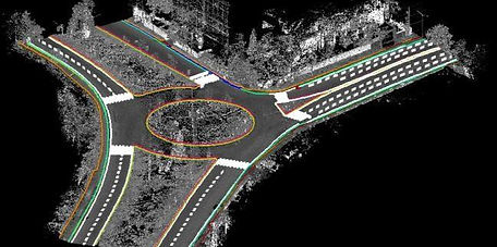
Transportation line Modelling
Floodplain mapping with 3D break lines
Mobile Mapping data classification & vector extraction
Digital Terrain Models (DTM), Digital Surface Models (DSM), Triangulated Irregular Networks (TIN), contour, and slope modeling